

The hurricane Miltonnow in category 5 as it approached Florida, went from a “tropical storm” to an “extremely dangerous” hurricane in less than 24 hours. What explains this phenomenon?
• Also read: Florida prepares for Category 4 Hurricane Milton
• Also read: ‘Milton’ becomes an ‘extremely dangerous Category 4 hurricane’ as it approaches Florida
Milton is moving with “astonishing” and “rapid” power, to the point where it becomes the most powerful storm observed on the planet this year, according to CNN findings.
This hurricane with sustained winds of 280 km/h becomes one of the ten most powerful hurricanes ever recorded in the Atlantic, since Dorian in 2019, which had sustained winds of 297 km/h.
It now ranks ninth, behind Katrina in 2005 and Maria in 2017.
The Cooperative Institute for Atmospheric Research (CIRA) has revealed a “stunning” view of the eye of Hurricane Milton on X.
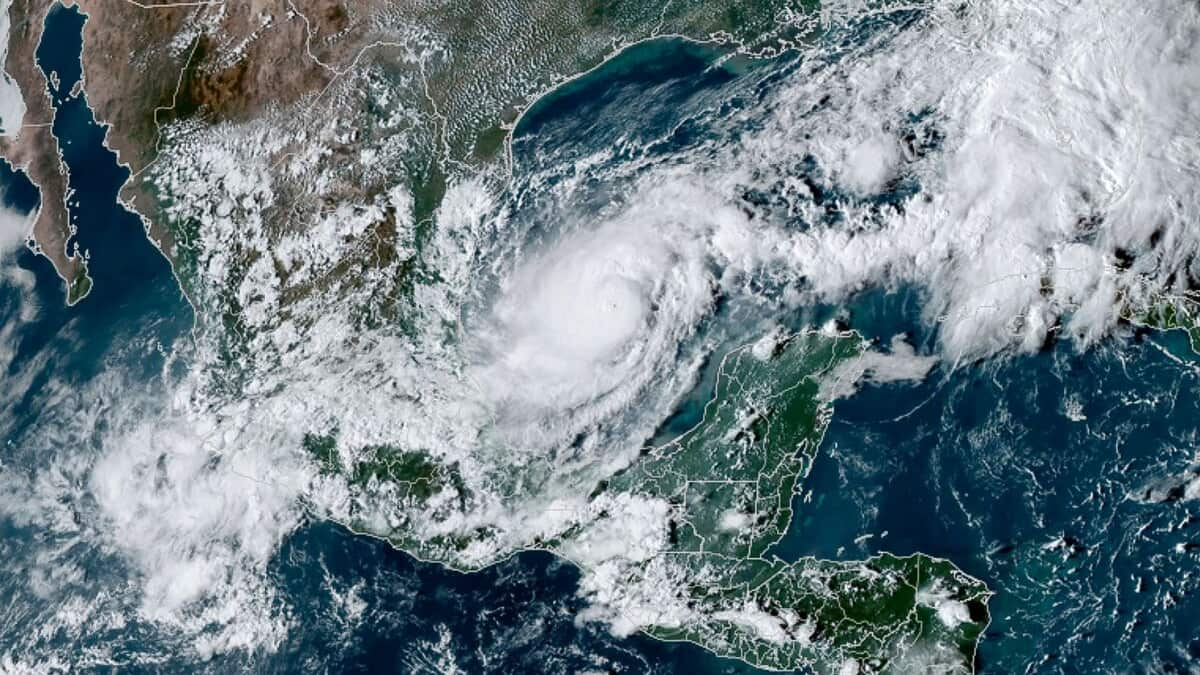
“Milton” reaches the maximum category in less than 24 hours
Milton was a tropical storm with sustained winds of 96 km/h and the possibility of becoming a major hurricane on Sunday.
Monday morning at 6 a.m., 24 hours later, the US Hurricane Center (NHC) indicated that Milton had become a “major hurricane” category 3 on the Saffir-Simpson scale, with winds of up to 195 km/h.
Two hours later, the storm rapidly intensified, now becoming a Category 4 hurricane with winds of up to 240 km/h, the NHC warned.
At 11 a.m., the NHC also specified that experts predicted that the hurricane would move into category 5.
The hurricane finally strengthened to category 5 at 12 p.m. Monday, the NHC announced. “Data from an Air Force Reserve Hurricane Hunter aircraft indicates that Milton has strengthened into category 5. Maximum sustained winds are estimated at 160 mph (257 km/h) with stronger gusts,” we can read on X.
Milton intensifies “explosively” Monday afternoon, now with winds up to 175 mph (281 km/h), the NHC said.
According to NHC data, the wind speed of “Milton” increased by 140 km/h in less than 24 hours.
This storm would also be the one that intensified the fastest among all other storms in the Gulf of Mexico in the last 40 years, according to the NHC.
Hurricane Milton is experiencing “extremely rapid intensification,” as its maximum sustained winds increased by at least 93 mph over a 24-hour period, according to the research group Climate Central.
The size of the inner core
A meteorologist explains that the hurricane Milton strengthens quickly, particularly due to the size of the inner core.
“The maximum wind radius of 18 km is relatively small and the radar resembles the dreaded pin’s eye,” Alex Boreham explained to publication X.
An inner core with a smaller size means “less work and less latent heat release is required to bring pressures down,” he continued.
“Explosive” intensification
Another meteorologist named Eric Webb notes that the hurricane is experiencing “truly explosive rates of intensification rarely seen or observed in the Atlantic basin,” we read on his publication X.
Moreover, he adds that the pressure of Milton dropping by around 5 megabytes (MB) and could hit the door to Category 5 status later Monday.
Eric Webb shared images of the eye wall of Milton which feature an “impressive” amount of lightning, noting that it is “insane and a clear indicator that this storm is intensifying explosively.”
The record heat of the water
Record heat in the Gulf of Mexico could play a role in the hurricane’s intensification, according to CNN meteorologist Mary Gilbert.
According to hurricane expert Brian McNoldy, water in the Gulf of Mexico has reached record levels of heat since August.
This rapid intensification of Milton could then be explained by global warming. “The planet is warming due to pollution from fossil fuels and bodies of water are warming and retaining heat,” said Mary Gilbert.
The fact that sea surface temperatures have increased significantly globally since April 2023 is contributing to the increase in rapidly intensifying hurricanes, Climate Central explained.
The American Weather Observatory (NOAA) warned at the end of May that the hurricane season, which extends from the beginning of June to the end of November, was shaping up to be an extraordinary year, with the possibility of four to seven Category 3 or more hurricanes.
