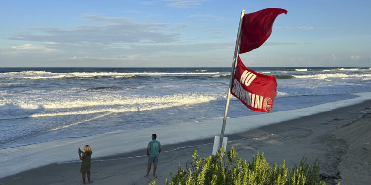
(Washington) Hurricane Erinwhich regained in power, is approaching on Wednesday from the east coast of the United States which it must follow without touching land, the American state of North Carolina is preparing for violent waves and potentially destructive floods.
What to know
- Early Wednesday morning, the hurricane Erin was about 730 kilometers from the Côtes de la Caroline du Nord;
- “Hurricane Erin will cause risks of flooding on the coast, erosion of the beaches and dangerous conditions to surf, “warned the governor of North Carolina, Josh Stein, who declared the state of emergency;
- Erin had very quickly strengthened during the weekend, he has since lost power, but has extended and could still strengthen in the coming hours;
- Despite calm beginnings, the hurricane season, which stretches from the beginning of June to the end of November, should this year be more intense than normal, according to forecasts by the American weather authorities;
This state in the south-east of the country had been devastated in the fall of 2024 by the hurricane Hélènethe second deadliest to have struck the continental United States in more than half a century, after Katrina in 2005.
Less than a year later, and while the memory of the devastating floods remains lively, the authorities of Caroline du Nord declared the state of emergency and ordered the populations of several localities to evacuate.
“I would like to emphasize the importance of taking this storm seriously, because it is a violent storm and the conditions could deteriorate quickly,” insisted state governor Josh Stein on Wednesday during a press conference.
If it is not planned that the hurricane touches earth, the trajectory ofErin Offshore should cause waves from the end of the day up to six meters and powerful winds, and raises fears of large floods, especially on a rosary of islands bordering the North Carolina.
Its effects will also be felt elsewhere, the weather authorities alerting in particular on dangerous currents near the beaches of the Bahamas and almost all of the American coast, as well as tropical storm conditions in Bermuda.
NASA satellite image, provided by Associated Press Archives
Hurricane Erin (left) continues its trajectory through the Atlantic Ocean, August 19, 2025
Always classified as a category 2 hurricane on the Saffir-Simpson scale which has five, Erin blows winds up to 175 km/h and should continue to strengthen, according to the American Hurricane Center (NHC).
He should become a “major hurricane”, that is to say, go to category 3 or more, “by the evening”, before probably weakening from Friday.
First hurricane of the season in the North Atlantic, Erin had previously changed in the Caribbean region, causing material damage, especially in Puerto Rico.
It had strengthened in the weekend at an exceptional speed, reaching a little more than 24 hours the maximum level of intensity.
Despite calm beginnings, the hurricane season, which stretches from early June to the end of November, should this year be more intense than normal, according to forecasts by the American weather authorities.
By warming the seas, climate change makes it more likely the rapid intensification of such storms and increases the risk of more powerful phenomena, according to scientists.
In 2024, the region had been marked by several deadly storms, including the hurricane Hélène which left more than 200 dead in the south-east of the United States.


