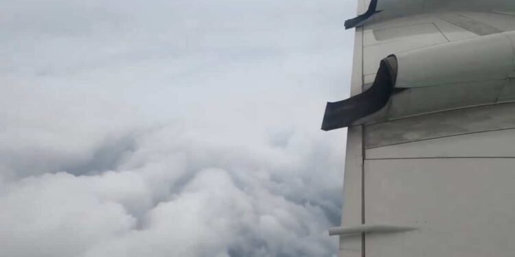
National Oceanic and Atmospheric Administration (NOAA) “hurricane chasers” experienced extreme turbulence during a flight within Milton to collect data on the storm. The video of the event went viral on social media.
• Also read: Here’s exactly what time ‘Milton’ will hit Florida
• Also read: Up to 4.5 meters of water: this is how Hurricane “Milton” could wreak havoc in Florida
Scientists have crossed Milton as the Category 4 hurricane packed winds of 249 km/h and headed toward the coast of Florida on Tuesday.
As on their previous missions, which typically last 8 to 10 hours, the team crossed “the eye wall of the hurricane, buffeted by howling winds, blinding rain and violent updrafts and downdrafts before to enter the relative calm of the eye of the storm,” NOAA said.
An extract from their flight, published on X Tuesday evening, was viewed more than 5 million times in a few hours. The calm of the crew and the skills of the pilot were highlighted by many Internet users in comments.
Others said they would never again be nervous due to turbulence on a commercial flight.
Better understand hurricanes
As they pass through a hurricane, NOAA scientists transmit live measurements of pressure, humidity, temperature, wind direction and speed, providing a detailed look at the storm’s structure and its intensity.
Wind speeds over the ocean and rain rates in hurricanes are also key indicators of storm surge, which is a leading cause of hurricane-related deaths.
It is in particular thanks to the data collected during these missions that the authorities can issue recommendations to the population.
• Also read: An experienced meteorologist struggles to hold back tears on air
The hurricane Milton will make landfall in Florida during the night from Wednesday to Thursday. It could be “the worst storm” to hit this region “in a century” according to President Joe Biden.
“You must evacuate now, it is a matter of life and death,” he warned residents of the country’s third most populous state.
− With information from AFP


